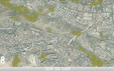
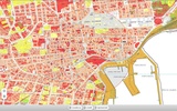
MobileMap Sicilia offers a valuable tool designed for geolocation enthusiasts and professionals seeking access to institutional maps of the Sicilian Region. It provides various cartographic services, allowing you to explore different thematic maps related to development plans, orthophotos, digital terrain models, and more. One notable feature of this app is its integration with the OMI Mobile Service, which lets you view real estate market prices as provided by the Agency of the territory. This enhances your ability to make informed decisions based on geospatial data.
User Interface and Accessibility
The user interface of MobileMap Sicilia is crafted to ensure straightforward navigation through geospatial data, although map loading speed relies on the Sicilian server's performance. It's important to recognize these maps for their study purposes, as they do not possess legal standing. The app facilitates access to a range of maps, such as CTR 10k, CTN 2k, and Quickbird coastal images, enhancing the usability for research or academic discussions.
Advanced Features for Comprehensive Analysis
MobileMap Sicilia enables consultation of maps like the Quality Index of the Climate, Desertification Sensitivity Index, and the Map of Land Use. Additional features, such as the Soil Quality Index and quality indices of vegetation and land management, support broader environmental assessments. Furthermore, the app offers insight into sensitive areas like SCI, SPA, parks, and nature reserves, while providing details on ecologically homogeneous zones and potential landslide hazards or risks.
Seamless Integration and Geospatial Exploration
MobileMap Sicilia incorporates WMS services, offering a streamlined way to access assorted metadata through a single platform. The app’s thematic richness is bolstered by metadata publication, advancing the ability to delve into detailed environmental and land-use statistics vital for research and spatial analysis.


Comments
There are no opinions about MobileMap Sicilia yet. Be the first! Comment